 Citta
CittaRoma Pass: Official City Card with Transportation
Unlock Rome's treasures with priority access to 45+ iconic sites. Enjoy unlimited public transport for 72 hours and save up to 40% compared to individual tickets.
From 55,57 €
 Airport
 Attraction
 District
 Village
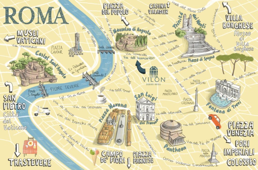
If you’re planning a trip to Rome, the interactive map on this page features all the main attractions we recommend visiting, along with other useful travel information such as the airport and towns around Rome. Simply click on the markers on the map or the list below to read detailed information about each point of interest.
If you’re looking for a free map of Rome’s city centre, showing the main monuments and metro lines, you’ll find below the best high-resolution PDF map of Rome, ready to print.
Rome Map in PDFYou’ll almost certainly use the underground to get around Rome, so a map of the lines might come in handy.
To view, download as a PDF and print it if needed, click the button below.
If you’re looking for a map showing all of Rome’s ZTL areas, green zones and the ring railway, you can view it by clicking the button below.
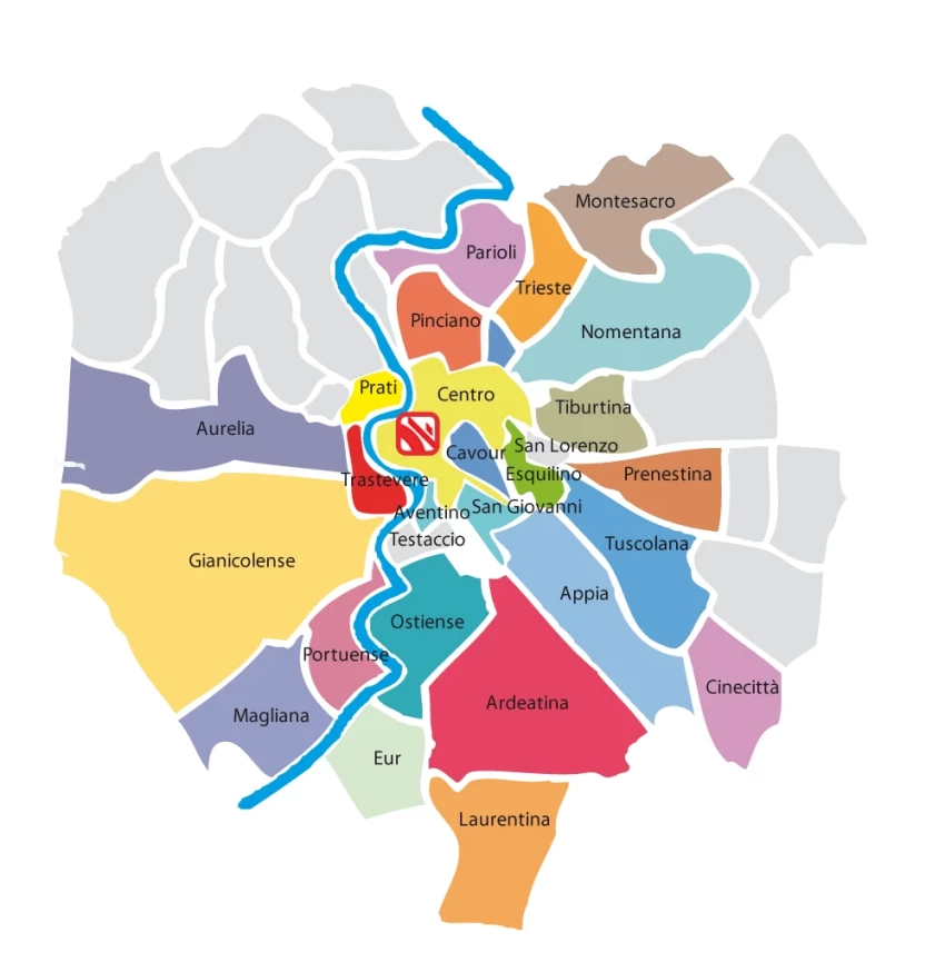
View Rome's ZTL mapBelow you’ll find a simplified map of Rome’s neighbourhoods, useful for getting an idea of distances, especially when choosing an area to stay.
City Card allow you to save on public transport and / or on the entrances to the main tourist attractions.
 Hotel
Hotel  Budget accommodations
  Apartments
  Family Hotel
  Luxury Hotel
  Resorts